→
Back
Drone Mapping | New ortomosaic upload and download flow
28 de mai. de 2026
In addition to sending georeferenced photos, it is now also possible to send pre-processed orthomosaics in .tif format and download the files directly through the platform.
The Drone Mapping workflow in Visi has become even more flexible and complete. With the new update, it is possible to directly upload a ready-to-use orthomosaic in .tif format, in addition to the existing option of uploading photos captured during the drone flight.
By adding the orthomosaic, it will be displayed on the platform without the need for additional processing. This means more freedom to use externally processed files and centralize everything in Visi for visualization, comparison between dates, and monitoring the evolution of the construction work.
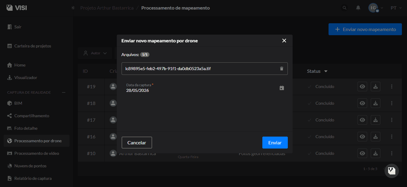
To upload the orthomosaic .tif file, you must enter the date of the survey and click submit:
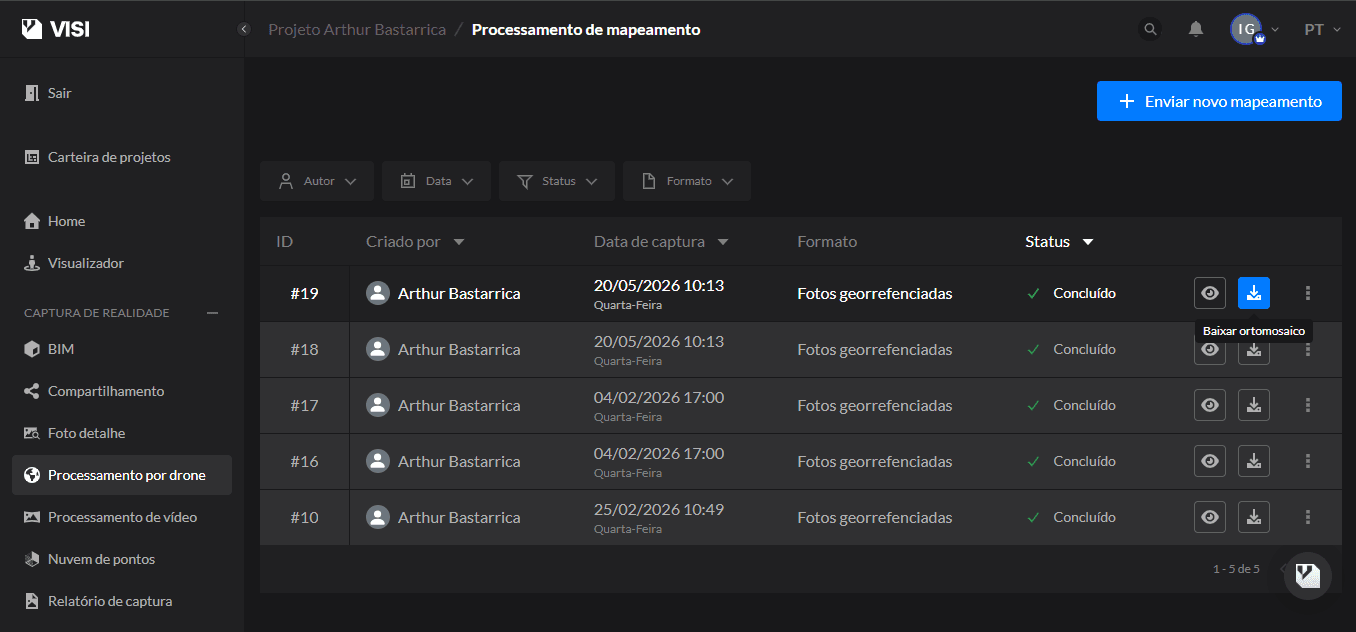
Additionally, it is now possible to download orthomosaics directly from the platform. After processing, simply access the mapping list, select the desired file, and click “Download Orthomosaic”:
The update also brought improvements to the processing environment, such as new statuses, identification of the orthomosaic's origin, and new options for re-uploading failed files.
Benefits
Upload already processed orthomosaics in .tif format
Centralize different mapping workflows on a single platform
Download orthomosaics directly from Visi
Have more control and transparency over the processing status
Re-upload failed files quickly and simply
Facilitate the sharing and storage of mappings
Learn more
How Visi's Drone Mapping works
SHARE ON SOCIAL MEDIA