→
Back
Point Cloud | Analyze your construction in 3D with more precision directly in Visi
23 de abr. de 2026
A new way to track the construction progress is now available on Visi. Navigate the job site in 3D with point clouds generated by drones or 3D laser scanning, bringing more detail, depth, and context to your analysis.
Visi has just taken another step in reality capture solutions.
In addition to the 3D scanning service with Construct IN's team of experts in high-precision surveys, our Visi platform now offers a Point Cloud viewer.
With the Point Cloud, you can now view the construction site in a three-dimensional environment with a high level of fidelity, expanding the way you understand the physical space and monitor execution.
The feature allows you to navigate through the construction site in 3D using drone or laser scan surveys, bringing more precision to analysis and validation directly within the platform.
In Drone Mapping, the point cloud is automatically generated from the uploaded images, allowing you to switch between the orthomosaic (2D) and the 3D view.
If you already have drone mapping enabled on your project, in addition to the orthomosaic, you will now have the point cloud view in the same environment.
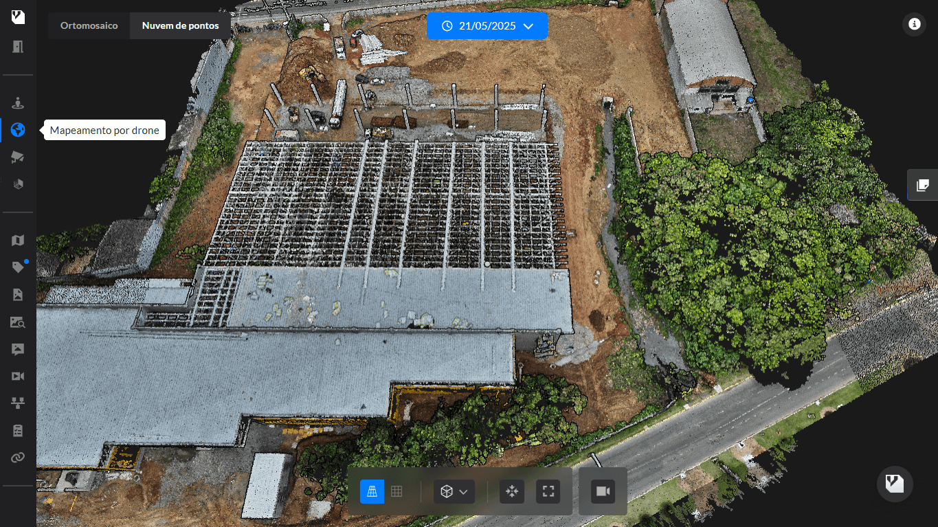
For laser scan surveys, you can upload files (.LAS/.LAZ and .E57) and have the point cloud linked to blueprints or project site plans, available in a dedicated viewer within the platform.
Navigation within the 3D model can also be combined with 360° photos, expanding the visual context during the analysis.
With this new feature, Visi expands the ways of interpreting the project, gathering different reality captures in a single environment and bringing more precision to monitor execution and support decisions throughout the project.
The feature is available in advanced plans, aimed at operations that require a higher level of detail and reliability in the analysis.
Benefits:
View the construction site in 3D with a high level of detail
Analyze the space with greater depth and precision
Switch between 2D and 3D views as needed
Navigate freely through the three-dimensional environment
Integrate drone, laser scan, and 360 photos into a single experience
Support decisions with more context and clarity
Learn more
How the Point Cloud viewer works
SHARE ON SOCIAL MEDIA