→
Back
Point Cloud | More context, scene orientation and precise measurements in the 3D model
23 de jul. de 2026
It is now possible to link the 3D survey to the floor plan and navigate more intuitively in the Visi Point Cloud, as well as extract measurements directly from the model for even more precise analyses.
Visi's Point Cloud viewer has become even more complete to support technical analyses of the construction work and to explore different spots of the site in a more fluid way.
In addition to visualizing the construction work in a three-dimensional environment, it is now possible to link the survey scenes to the floor plan, facilitating orientation within the model and through the 360° photos.
This linking is available in formats that feature 360° photos of the survey, allowing a clearer understanding of the location and direction during navigation.

Another new feature is the Measurements tool, which allows extracting distances directly from the point cloud for dimension verification, execution validation, and support for building BIM models.
Measurements can be taken between two or more points, with 3D visualization or horizontal and vertical projections, in addition to the possibility of copying values and coordinates for use in other analyses.
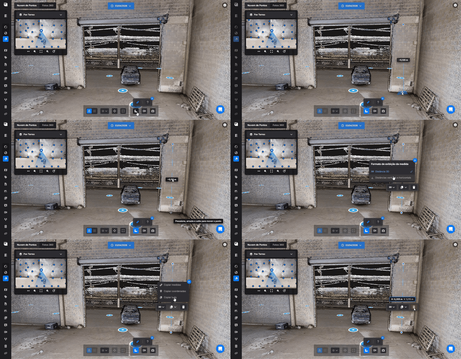
The measurement functionality is available both in the cloud generated by drones and in the cloud generated by laser scanning.
With these evolutions, the Point Cloud viewer now offers even more context, navigation orientation, and precision for analyzing three-dimensional surveys directly in Visi.
Benefits
Navigate through the point cloud with orientation from the floor plan
View the position and direction of scenes during navigation
Extract measurements directly from the 3D model
Check dimensions and validate executions without going to the field
Copy measurements and coordinates to support analyses and BIM models
Seamlessly switch between point cloud and 360° photos
Learn more
How the Visi Point Cloud works
SHARE ON SOCIAL MEDIA