Construct IN
17 de abr. de 2025


Isis Gonzaga
Journalist

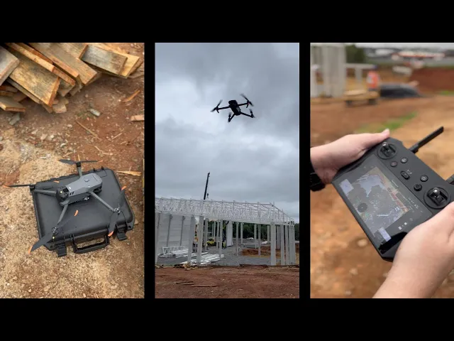
The drone technology has revolutionized the way engineers, managers, and construction companies document and monitor their projects. The VISI by Construct IN platform — a reference in reality capture for remote project management with 360° images — has just taken a significant step forward with Drone Capture. This technology allows capturing aerial images and further expanding the visual coverage of construction sites.
If you seek speed, practicality, and full visibility of your project, keep reading and discover how to transform the monitoring of your work with 360° drone images.
Drone for remote project management
The use of drones in construction is not new, but its application has evolved rapidly. Following the trend and in pursuit of excellence in remote project management with innovative reality capture technologies, VISI has combined aerial images with the already established logic of ground captures using 360° cameras.
The drone technology not only enables viewing the site in a panoramic way but also documenting the progress of the project with clarity and speed, as it requires less movement during captures at the site, making the process faster. Thus, the platform allows for even more complete and immersive remote management.
Drone Capture with VISI by Construct IN
Simple and ready to transform your project management, the drone integrated with the Construct IN software allows registering the entire site with immersive aerial images, facilitating the routine for those capturing and managing. See how it works:
Plan the capture points
On the platform, select the locations on the plan where you wish to capture aerial images. These points will be used to link the images taken with the drone.
Set the panoramic mode on the drone
On your drone, select the panoramic mode (panorama), a standard feature in most models that allows the sequential capture of several images for building the spherical image.
Multiple images, one result
During the flight, the drone takes several clicks in sequence, rotating around a fixed point in the sky. The result will be a panoramic image representing the entire area around.
Upload the images
On the first use, you will upload the photos manually to link them to the points created on the floor plan or layout. After this initial setup, subsequent images will be linked automatically according to the GPS coordinates captured by the drone.
Monitor the site from anywhere
With the images already available in the system, you can navigate the construction site directly on the platform and manage remotely, with the same fluidity as viewing images from 360° cameras — but now with a new aerial perspective.
Drone models compatible with VISI
The VISI system is compatible with any drone model that has the function to capture panoramic images in 360°. This means that if your drone has panorama mode, it can be used to document the project with the platform.
Check out some DJI drone models that work with VISI:
DJI Mini 3
DJI Mini 3 Pro
DJI Mini 4
DJI Mini 4 Pro
DJI Mavic Air 2S
DJI Mavic 2 Pro
DJI Mavic 3
These are just a few examples. If you already have or use another drone model and want to confirm compatibility, get in touch with our team.
Fast documentation, ideal for large projects
The integration with drones on the platform has been designed to specifically meet the demands of projects that require a broad and strategic view of the site. Outdoor projects, in the initial phase, with extensive areas or difficult coverage by ground capture directly benefit from this new approach to aerial documentation.
This solution is ideal for infrastructure projects and horizontal developments, where moving across the terrain can be time-consuming and inefficient. It is also highly recommended for subdivisions, industrial complexes, and sites with large built areas, providing a complete panoramic view with speed.
Just like the 360° cameras, the 360° Drone streamlines the capture of visual data and reduces the time spent on in-person visits, offering monitoring from a new perspective. Managers seeking transparency in tracking, more control over execution, and optimized remote management will also find a great ally in this resource.
In summary, the 360° Drone is ideal for:
Horizontal projects, subdivisions, and large construction sites
Industries and large-scale enterprises
Teams that need to document quickly and accurately
Managers who value control, time-saving, and total visibility of the project
Advantages of capturing the reality of the project with a Drone
Drone capture brings even greater visibility for remote monitoring of works with aerial 360° images. Thus, it is possible to use the drone solution alone to document the project, depending on the type of construction, or as a complement to images captured on the ground with 360° cameras. In addition to gaining more flexibility, you ensure total transparency for remote monitoring.
Practicality: Capture the project completely without needing to walk through the entire area.
Speed: Document large areas in less time
Integration: Set aerial points directly on the floor plan or layout of the project
Transparency: Ensure total visibility for remote monitoring
Cost-saving: Reduce time and costs with on-site visits to monitor the project
Get a broad view of your projects, now from above
We are a reference in reality capture, providing remote management through 360° images of the construction site. With drone capture, this experience can be even better and more innovative.
The drone allows capturing aerial images in 360°, offering a broad and detailed perspective of the site. With this technology, you can monitor the evolution of your project efficiently and practically, without wasting time during the capture process and ensuring complete remote management.
Schedule a free demonstration for more details about VISI's capture technologies and start transforming the monitoring of your projects right now.
Click here to speak with our specialists.
Sobre o autor
Isis Gonzaga
Journalist
Jornalista com expertise em Marketing de Conteúdo e Produto, transformando conhecimentos de copywriting em estratégias e lançamentos de sucesso.
cOMPARTILHE NAS REDES
Recomendado para você
carregar mais ↓


Subscribe to our newsletter
Explore nossas soluções
Entre em contato e descubra como a captura da realidade e dados centralizados podem ser a solução para a gestão de suas obras.
