Construct IN
19 de set. de 2025
Laser Scanning: everything you need to know and how to apply it to construction projects
Laser Scanning: everything you need to know and how to apply it to construction projects
Understand its types, how it works, and the difference from 360° cameras
Understand its types, how it works, and the difference from 360° cameras


Tales Silva
CEO & founder, Construct IN
cOMPARTILHE NAS REDES
cOMPARTILHE NAS REDES
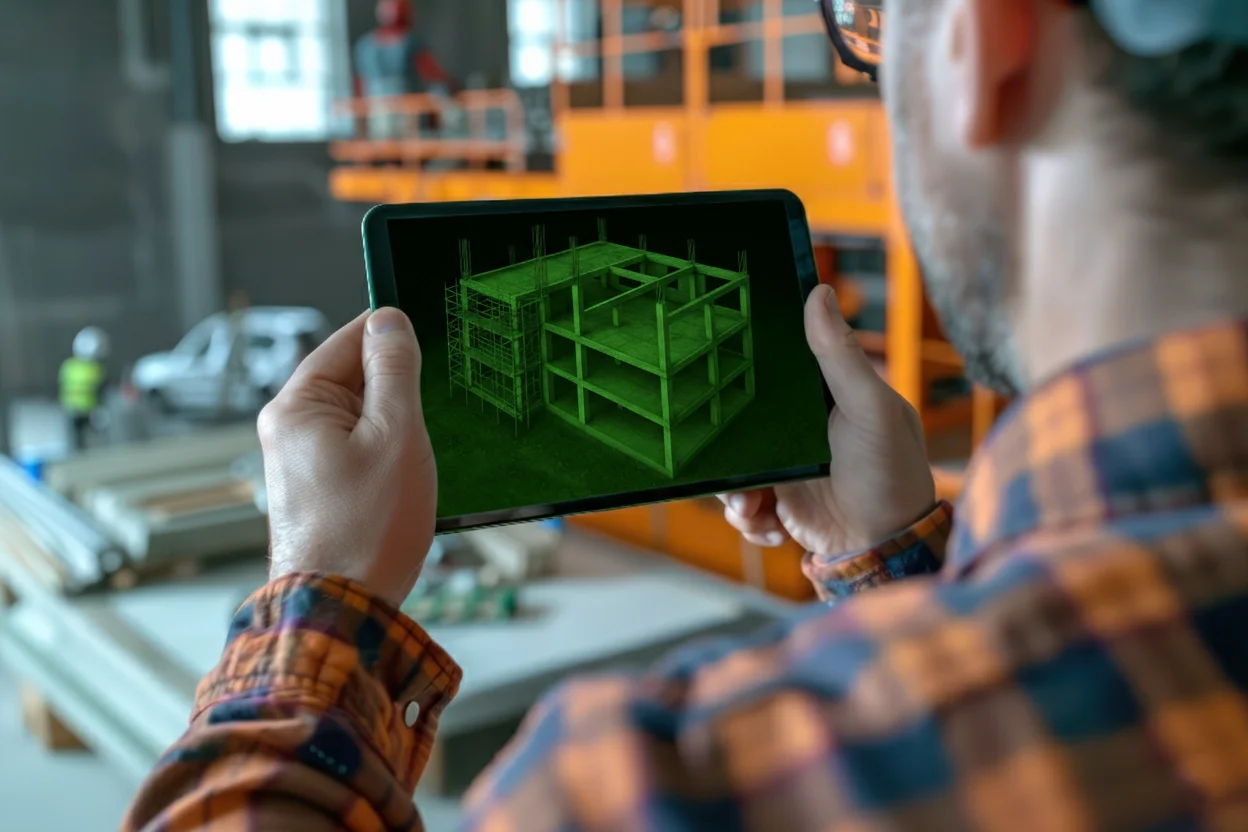
Image: Freepik/Borin
Some of the very common problems in construction projects stem from the lack of reliable information: manual measurements, undetected incompatibilities, or difficulties in tracking what is actually happening on site. That is where Laser Scanning comes in as an ally.
What is Laser Scanning?
Laser scanning is a technology that works by emitting laser beams onto the surface of objects or spaces.
The equipment records the points hit, generating millions of coordinates in a fast and automated process.
The result is the so-called point cloud, a geometric representation composed of coordinates (x, y, z) and additional attributes.
These attributes can include:
Color (RGB), when combined with photographic images;
Distance relative to a reference point;
Reflectance of the scanned material;
Temperature or other specific properties, which can be displayed in a "false color" scale.
With this, it is possible to record everything from a small ornamental detail to the volume of entire buildings or even urban areas, achieving sub-millimeter precision depending on the equipment and methodology applied.
The images usually look like this:

AI-generated image
Types of Laser Scanning
The types of laser scanning vary according to the platform, type of measurement, and technology.
By platform
The types of laser scanning by platform are TLS, MLS, ALS, and Handheld.
1. Terrestrial Laser Scanner (TLS)
The terrestrial scanner is installed in a stationary manner, positioned on the ground to capture three-dimensional information.
It generates an extremely detailed point cloud, with a range that can vary on average from 50 to 300 meters.
This precision makes it widely used in topographic surveys, as-built documentation, structural inspections, and continuous monitoring of ongoing construction works.
2. Mobile Laser Scanner (MLS)
In the case of the mobile scanner, the scanning is done during movement, as the equipment can be attached to vehicles, drones, or even operated manually.
This format is ideal for mapping large areas, such as cities, highways, and linear construction sites, as it combines speed with complex data collection.
Additionally, it combines 3D capture with GPS and IMU systems, ensuring positioning accuracy and more complete results in dynamic environments.
3. Airborne Laser Scanner (ALS)
The airborne scanner is mounted on aircraft or drones and its main advantage is the ability to map extensive territories in a short time.
Therefore, it is widely used in urban surveys, forested areas, irregular terrains, and hard-to-reach regions. The advantage of this model lies in the possibility of generating homogeneous information from vast areas with much more speed than traditional methods.
4. Handheld Laser Scanner
Handheld scanners are compact, lightweight, and easy-to-transport equipment.
Although they do not have the same range and level of precision as fixed or airborne models, they offer mobility and convenience, making them suitable for quick surveys in indoor environments, spot inspections, and hard-to-reach places.
Because of this, they have become an efficient solution when the goal is flexibility without compromising reliability.
By measurement
The types of laser scanning by measurement are: Time of Flight (ToF), Phase Shift, and laser triangulation.
Time of Flight (ToF) measures the time the laser pulse takes to travel to the object and return, being the most suitable for longer distances.
Phase Shift calculates the phase difference between the emitted and received pulses, allowing for faster and more precise measurements at shorter distances.
Laser triangulation, which is commonly used in handheld scanners, especially for mapping nearby objects and capturing finer details with high fidelity.
By technology
This technology also has types of laser scanning divided by: Rotary (spinning), Solid-State, Flash LiDAR, and Linear.
Rotary (spinning): the laser rotates 360° to capture the entire surrounding area;
Solid-State: has no moving parts, is compact and resistant, common in drones and automotive applications;
Flash LiDAR: captures an entire scene in a single pulse, like a "3D photo". Useful for short distances and real-time;
Linear: scans line by line, usually in fixed or airborne scanners.
Laser scanning vs. 360° cameras: what is the difference?
Laser Scanning and 360° cameras have distinct but complementary objectives:
Laser Scanning: captures precise 3D geometric data, ideal for technical measurements, "as-built" documentation, deformation analysis, and BIM integration. However, it requires more complex equipment, specialized labor, and significant time to process and extract value from the data.
360° Cameras: offer an immersive panoramic view of the job site, perfect for communication, visual inspection, remote tracking, and photographic history. They are more accessible: low-cost equipment, quick training, and immediate value extraction.

While Laser Scanning provides millimeter precision, 360° cameras offer a practical day-to-day view. Together, they create a complete strategy for construction monitoring.
How to use Laser Scanning in construction monitoring?
It is during execution that Laser Scanning shows its full value. By conducting periodic surveys, it generates data that allows you to:
Compare as-built with as-planned, identifying deviations before they turn into losses;
Assess volumes of moved materials, such as concrete or earth;
Detect structural deformations and pathologies still in the early stages;
Ensure compliance with norms, technical, and regulatory standards;
Record a detailed visual and technical history, useful for audits and decision-making.
With this, the manager gains full transparency of the project's progress, can act quickly on corrections, and avoids extra costs that could compromise the ROI.
FAQ: People also ask
What is a laser scanner used for?
A laser scanner is used to accurately capture the shape and dimensions of objects or environments, generating a 3D point cloud that can be used in design, inspections, maintenance, and digital modeling.
What is 3D laser scanning?
3D laser scanning is the process of transforming physical space or objects into a three-dimensional digital model, recording every point of the surface for analysis, measurements, and simulations in specialized software.
Monitoring your construction projects from a distance just got easier!
The Visi is our software for remote construction management that captures reality at the construction site with 360° images, videos, and drones.
It does not yet have integration with Laser Scanning, but it delivers strategic differentials for the day-to-day operations of construction projects.
While Laser Scanning solutions are recommended for those who truly need millimeter-precise measurements and highly technical analysis, Visi prevents teams from investing in a more expensive and complex technology when the goal is to gain practical, quick, and continuous visibility of the construction site.
Discover all of our tools and feel free to request a no-obligation demo.
Some of the very common problems in construction projects stem from the lack of reliable information: manual measurements, undetected incompatibilities, or difficulties in tracking what is actually happening on site. That is where Laser Scanning comes in as an ally.
What is Laser Scanning?
Laser scanning is a technology that works by emitting laser beams onto the surface of objects or spaces.
The equipment records the points hit, generating millions of coordinates in a fast and automated process.
The result is the so-called point cloud, a geometric representation composed of coordinates (x, y, z) and additional attributes.
These attributes can include:
Color (RGB), when combined with photographic images;
Distance relative to a reference point;
Reflectance of the scanned material;
Temperature or other specific properties, which can be displayed in a "false color" scale.
With this, it is possible to record everything from a small ornamental detail to the volume of entire buildings or even urban areas, achieving sub-millimeter precision depending on the equipment and methodology applied.
The images usually look like this:
AI-generated image
Types of Laser Scanning
The types of laser scanning vary according to the platform, type of measurement, and technology.
By platform
The types of laser scanning by platform are TLS, MLS, ALS, and Handheld.
1. Terrestrial Laser Scanner (TLS)
The terrestrial scanner is installed in a stationary manner, positioned on the ground to capture three-dimensional information.
It generates an extremely detailed point cloud, with a range that can vary on average from 50 to 300 meters.
This precision makes it widely used in topographic surveys, as-built documentation, structural inspections, and continuous monitoring of ongoing construction works.
2. Mobile Laser Scanner (MLS)
In the case of the mobile scanner, the scanning is done during movement, as the equipment can be attached to vehicles, drones, or even operated manually.
This format is ideal for mapping large areas, such as cities, highways, and linear construction sites, as it combines speed with complex data collection.
Additionally, it combines 3D capture with GPS and IMU systems, ensuring positioning accuracy and more complete results in dynamic environments.
3. Airborne Laser Scanner (ALS)
The airborne scanner is mounted on aircraft or drones and its main advantage is the ability to map extensive territories in a short time.
Therefore, it is widely used in urban surveys, forested areas, irregular terrains, and hard-to-reach regions. The advantage of this model lies in the possibility of generating homogeneous information from vast areas with much more speed than traditional methods.
4. Handheld Laser Scanner
Handheld scanners are compact, lightweight, and easy-to-transport equipment.
Although they do not have the same range and level of precision as fixed or airborne models, they offer mobility and convenience, making them suitable for quick surveys in indoor environments, spot inspections, and hard-to-reach places.
Because of this, they have become an efficient solution when the goal is flexibility without compromising reliability.
By measurement
The types of laser scanning by measurement are: Time of Flight (ToF), Phase Shift, and laser triangulation.
Time of Flight (ToF) measures the time the laser pulse takes to travel to the object and return, being the most suitable for longer distances.
Phase Shift calculates the phase difference between the emitted and received pulses, allowing for faster and more precise measurements at shorter distances.
Laser triangulation, which is commonly used in handheld scanners, especially for mapping nearby objects and capturing finer details with high fidelity.
By technology
This technology also has types of laser scanning divided by: Rotary (spinning), Solid-State, Flash LiDAR, and Linear.
Rotary (spinning): the laser rotates 360° to capture the entire surrounding area;
Solid-State: has no moving parts, is compact and resistant, common in drones and automotive applications;
Flash LiDAR: captures an entire scene in a single pulse, like a "3D photo". Useful for short distances and real-time;
Linear: scans line by line, usually in fixed or airborne scanners.
Laser scanning vs. 360° cameras: what is the difference?
Laser Scanning and 360° cameras have distinct but complementary objectives:
Laser Scanning: captures precise 3D geometric data, ideal for technical measurements, "as-built" documentation, deformation analysis, and BIM integration. However, it requires more complex equipment, specialized labor, and significant time to process and extract value from the data.
360° Cameras: offer an immersive panoramic view of the job site, perfect for communication, visual inspection, remote tracking, and photographic history. They are more accessible: low-cost equipment, quick training, and immediate value extraction.
While Laser Scanning provides millimeter precision, 360° cameras offer a practical day-to-day view. Together, they create a complete strategy for construction monitoring.
How to use Laser Scanning in construction monitoring?
It is during execution that Laser Scanning shows its full value. By conducting periodic surveys, it generates data that allows you to:
Compare as-built with as-planned, identifying deviations before they turn into losses;
Assess volumes of moved materials, such as concrete or earth;
Detect structural deformations and pathologies still in the early stages;
Ensure compliance with norms, technical, and regulatory standards;
Record a detailed visual and technical history, useful for audits and decision-making.
With this, the manager gains full transparency of the project's progress, can act quickly on corrections, and avoids extra costs that could compromise the ROI.
FAQ: People also ask
What is a laser scanner used for?
A laser scanner is used to accurately capture the shape and dimensions of objects or environments, generating a 3D point cloud that can be used in design, inspections, maintenance, and digital modeling.
What is 3D laser scanning?
3D laser scanning is the process of transforming physical space or objects into a three-dimensional digital model, recording every point of the surface for analysis, measurements, and simulations in specialized software.
Monitoring your construction projects from a distance just got easier!
The Visi is our software for remote construction management that captures reality at the construction site with 360° images, videos, and drones.
It does not yet have integration with Laser Scanning, but it delivers strategic differentials for the day-to-day operations of construction projects.
While Laser Scanning solutions are recommended for those who truly need millimeter-precise measurements and highly technical analysis, Visi prevents teams from investing in a more expensive and complex technology when the goal is to gain practical, quick, and continuous visibility of the construction site.
Discover all of our tools and feel free to request a no-obligation demo.
Image: Freepik/Borin
Sobre o autor
Tales Silva
CEO & founder, Construct IN
Tales Silva é Engenheiro Civil formado pela PUCRS (2016) e possui MBA Executivo com foco em marketing pela ESPM-Sul (2019). Tem experiência em projetos estruturais e em construções industrializadas. É fundador e CEO da Construct IN, construtech que oferece uma plataforma de gestão e documentação de obras por meio de imagens 360º.
cOMPARTILHE NAS REDES
Recomendado para você
carregar mais ↓


Subscribe to our newsletter
Explore nossas soluções
Entre em contato e descubra como a captura da realidade e dados centralizados podem ser a solução para a gestão de suas obras.
