Construct IN
15 de set. de 2025
LiDAR: what is it and how is it applied in Civil Construction?
LiDAR: what is it and how is it applied in Civil Construction?
Learn how to apply for accurate measurements, 3D surveys, and efficient construction monitoring
Learn how to apply for accurate measurements, 3D surveys, and efficient construction monitoring


Tales Silva
CEO & founder, Construct IN
cOMPARTILHE NAS REDES
cOMPARTILHE NAS REDES
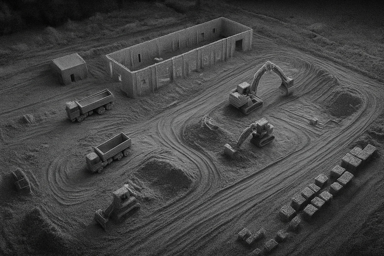
Image generated by Chat GPT
Manual measurements and traditional surveys on construction sites are slow, prone to errors, and increase the risk of delays and budget overruns.
It is in this scenario that LiDAR (Light Detection and Ranging) stands out as a technology capable of transforming how engineers and builders plan, measure, and monitor projects.
With the ability to generate detailed 3D models in a matter of seconds, LiDAR brings more precision, efficiency, and safety to every stage of civil construction.
What is LiDAR?
LiDAR, or Light Detection and Ranging, is a technology that emits laser pulses at a surface to "scan" the environment and create a 3D model.
When this light beam returns to the sensor, the system measures the time it took to travel back and forth and, based on that, calculates the exact distance to the object.
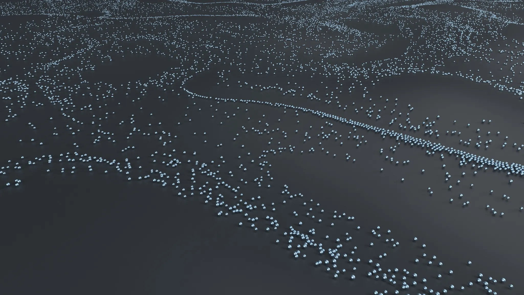
The result of this process is the so-called 3D point cloud, an extremely detailed digital model of the surveyed environment.
By combining this calculation with the sensor's position and orientation (obtained by positioning systems), it is possible to map three-dimensional coordinates X (on the horizontal axis), Y (on the vertical axis), and Z (height/depth) with centimeter accuracy.
In just a few seconds, a LiDAR system can collect millions of measurement points, forming a faithful digital representation of the mapped surface.

Image generated by ChatGPT of a construction site using a point cloud
3 types of LiDAR platforms
LiDAR technology can be classified according to the platform on which the system is mounted. There are three main categories: spaceborne, airborne, and terrestrial (ground-based).
1) Spaceborne LiDAR
Uses satellites, space shuttles, or space stations as an operations base, being more common on satellite platforms.
Its key advantage is the broad observation coverage, ideal for large-scale applications such as global monitoring.
It is used in studies of changes in polar ice caps, lake levels, forest heights, biomass, and carbon stocks.
However, due to the high cost, it is still primarily conducted by national space agencies and is not commercialized.
2) Airborne LiDAR
Operates from fixed-wing aircraft, helicopters, or drones (UAVs). It is characterized by high efficiency and point density, covering from tens to thousands of square kilometers in just a few hours.
It is the most common type for generating Digital Elevation Models (DEMs). In general, they include a laser scanner and GPS to determine location and orientation.
You will like to know: 360° Drone: The technology that will transform construction site documentation
3) Terrestrial LiDAR (Ground-based)
Includes scanners fixed on tripods, systems mounted on vehicles, ships, backpacks, or hand-held devices.
It allows for detailed acquisition of information, including indoor spaces, with extremely high precision and point density.
Scanners on tripods can achieve centimeter accuracy (up to 1 cm), being widely used in localized surveying and frequent mapping.
There are different types of terrestrial scanners: window scanners (rectangular field), panoramic (360° horizontal and up to 90° vertical view), and spherical (expanded view, limited only by the occlusion of the equipment itself).
Its applications include mapping of railways, highways, airports, buildings, bridges, beaches, and even atmospheric studies.
What is it used for?
LiDAR is fundamental in activities such as measurement, surveying, construction monitoring, and many other activities. This time, we will focus on construction.
Surveying
LiDAR creates high-quality Digital Elevation Models (DEMs) and Digital Terrain Models (DTMs), which serve as cartographic bases for the planning and design of engineering works.
Its ability to scan the environment with millions of points allows for the faithful representation of structures like railways, highways, bridges, and buildings.
Another differentiator is the penetration of laser pulses in areas with dense vegetation, allowing for more precise terrain models in forested locations, which is difficult to achieve with other techniques.
Physical measurement
Unlike traditional methods, physical measurement with LiDAR is contactless, eliminating the need to install prisms and making it possible to reach complex or hazardous areas, such as slopes, tunnels, or elevated structures.
The generated point cloud also allows for the precise calculation of excavation and earthwork volumes, assisting in cost control and progress tracking.
Monitoring
During the execution phase, LiDAR makes it possible to track the construction in real time, generating automatic alerts for discrepancies, anomalies, or risks.
Predictive analyses process point clouds to identify potential failures and anticipate issues that could compromise the project.
In addition, comparing point clouds collected at different times with the original design (in BIM or CAD) ensures compliance and quality in execution.
The technology also contributes to safety inspections in infrastructure, and, when integrated into collaborative platforms, improves communication between teams, reduces rework, and optimizes resource management.

Differences between LiDAR and traditional methods
LiDAR stands out compared to techniques such as photogrammetry, radar, or total stations.
While traditional methods demand more time in the field, depend on specific lighting conditions, or require physical contact (like reflective prisms), LiDAR collects data quickly, contactlessly, and independently of ambient light.
Furthermore, the technology has the ability to penetrate vegetation and capture terrain information even in densely covered areas, which is limited in other processes.
LiDAR vs. Reality Capture with 360-degree cameras
Although LiDAR delivers a highly accurate point cloud, it is important to highlight that this process requires:
More complex and high-cost equipment;
Specialized labor;
Considerable time to process and extract value from the data.
On the other hand, reality capture with 360° cameras, utilized by Visi, stands out by:
Using affordable equipment;
Requiring only quick training;
Being easy and practical to extract value on a daily basis.
Benefits of LiDAR for builders and engineers
LiDAR brings several advantages for construction managers, such as data precision and quality, efficiency, cost reduction, digitization, and collaboration.
Precision and data quality
The technology delivers 3D spatial information with high precision, reaching centimeter-level accuracy. It also allows for the generation of dense point clouds, capturing fine details of the environment, and has the ability to penetrate vegetation areas to map the terrain faithfully.
Efficiency and cost reduction
LiDAR scans large areas in a short amount of time, collecting a massive amount of data in a single pass.
This process reduces costs and time right from the planning phase, and, when integrated with artificial intelligence, allows for predictive analyses that anticipate problems and optimize resource management.
Digitization and collaboration
By digitizing the job site — often with the help of drones equipped with LiDAR — companies achieve higher productivity and reduce errors.
The integration of information into collaborative platforms makes communication between designers, engineers, and executors faster, reduces rework, and strengthens decision-making during execution.

Limitations of LiDAR in Civil Construction
Despite all the benefits, LiDAR technology also presents limitations that engineers and construction firms must consider when applying it to projects.
These limitations do not invalidate the use of the technology, but they do require qualitative review to ensure the reliability of the results:
Weather conditions
LiDAR laser pulses are sensitive to bad weather. Heavy rain, snow, fog, or smoke reduce measurement accuracy, and the technology cannot penetrate dense clouds. Because of this, airborne collections are often conducted at night when the air is cleaner and air traffic is lower.
Difficulty in target detection
The narrow laser beam can make it difficult to identify targets, decreasing efficiency in interception and affecting detection quality.
Land cover classification
Although LiDAR is excellent for mapping vertical structures, its 3D point cloud can be less efficient than traditional 2D images for classifying specific types of land cover.
Resolution loss with distance
The spatial resolution of LiDAR decreases as the measurement distance increases. This can cause distortions known as aliasing, where fine details are interpreted incorrectly, compromising data fidelity.
Potential errors in data
During processing, issues can occur such as misalignments between flight lines, noise that creates small parallel ridges in the terrain model, point classification errors (such as ground being identified as vegetation), and even areas with missing data.
Monitor your projects with the Visi reality capture software
The Visi software does not yet feature point cloud/LiDAR integration, but it delivers strategic benefits that often better fit the reality of job sites: practical, fast, and continuous visibility of the construction site, without the costs and complexity of LiDAR.
Discover, in practice, some of our features: images, videos, and use of 360-degree drones, schedule tracking, comparison of progress with BIM design, dashboards, creation of photo reports, Daily Construction Reports (DCR), AI, and much more!
Manual measurements and traditional surveys on construction sites are slow, prone to errors, and increase the risk of delays and budget overruns.
It is in this scenario that LiDAR (Light Detection and Ranging) stands out as a technology capable of transforming how engineers and builders plan, measure, and monitor projects.
With the ability to generate detailed 3D models in a matter of seconds, LiDAR brings more precision, efficiency, and safety to every stage of civil construction.
What is LiDAR?
LiDAR, or Light Detection and Ranging, is a technology that emits laser pulses at a surface to "scan" the environment and create a 3D model.
When this light beam returns to the sensor, the system measures the time it took to travel back and forth and, based on that, calculates the exact distance to the object.
The result of this process is the so-called 3D point cloud, an extremely detailed digital model of the surveyed environment.
By combining this calculation with the sensor's position and orientation (obtained by positioning systems), it is possible to map three-dimensional coordinates X (on the horizontal axis), Y (on the vertical axis), and Z (height/depth) with centimeter accuracy.
In just a few seconds, a LiDAR system can collect millions of measurement points, forming a faithful digital representation of the mapped surface.
Image generated by ChatGPT of a construction site using a point cloud
3 types of LiDAR platforms
LiDAR technology can be classified according to the platform on which the system is mounted. There are three main categories: spaceborne, airborne, and terrestrial (ground-based).
1) Spaceborne LiDAR
Uses satellites, space shuttles, or space stations as an operations base, being more common on satellite platforms.
Its key advantage is the broad observation coverage, ideal for large-scale applications such as global monitoring.
It is used in studies of changes in polar ice caps, lake levels, forest heights, biomass, and carbon stocks.
However, due to the high cost, it is still primarily conducted by national space agencies and is not commercialized.
2) Airborne LiDAR
Operates from fixed-wing aircraft, helicopters, or drones (UAVs). It is characterized by high efficiency and point density, covering from tens to thousands of square kilometers in just a few hours.
It is the most common type for generating Digital Elevation Models (DEMs). In general, they include a laser scanner and GPS to determine location and orientation.
You will like to know: 360° Drone: The technology that will transform construction site documentation
3) Terrestrial LiDAR (Ground-based)
Includes scanners fixed on tripods, systems mounted on vehicles, ships, backpacks, or hand-held devices.
It allows for detailed acquisition of information, including indoor spaces, with extremely high precision and point density.
Scanners on tripods can achieve centimeter accuracy (up to 1 cm), being widely used in localized surveying and frequent mapping.
There are different types of terrestrial scanners: window scanners (rectangular field), panoramic (360° horizontal and up to 90° vertical view), and spherical (expanded view, limited only by the occlusion of the equipment itself).
Its applications include mapping of railways, highways, airports, buildings, bridges, beaches, and even atmospheric studies.
What is it used for?
LiDAR is fundamental in activities such as measurement, surveying, construction monitoring, and many other activities. This time, we will focus on construction.
Surveying
LiDAR creates high-quality Digital Elevation Models (DEMs) and Digital Terrain Models (DTMs), which serve as cartographic bases for the planning and design of engineering works.
Its ability to scan the environment with millions of points allows for the faithful representation of structures like railways, highways, bridges, and buildings.
Another differentiator is the penetration of laser pulses in areas with dense vegetation, allowing for more precise terrain models in forested locations, which is difficult to achieve with other techniques.
Physical measurement
Unlike traditional methods, physical measurement with LiDAR is contactless, eliminating the need to install prisms and making it possible to reach complex or hazardous areas, such as slopes, tunnels, or elevated structures.
The generated point cloud also allows for the precise calculation of excavation and earthwork volumes, assisting in cost control and progress tracking.
Monitoring
During the execution phase, LiDAR makes it possible to track the construction in real time, generating automatic alerts for discrepancies, anomalies, or risks.
Predictive analyses process point clouds to identify potential failures and anticipate issues that could compromise the project.
In addition, comparing point clouds collected at different times with the original design (in BIM or CAD) ensures compliance and quality in execution.
The technology also contributes to safety inspections in infrastructure, and, when integrated into collaborative platforms, improves communication between teams, reduces rework, and optimizes resource management.
Differences between LiDAR and traditional methods
LiDAR stands out compared to techniques such as photogrammetry, radar, or total stations.
While traditional methods demand more time in the field, depend on specific lighting conditions, or require physical contact (like reflective prisms), LiDAR collects data quickly, contactlessly, and independently of ambient light.
Furthermore, the technology has the ability to penetrate vegetation and capture terrain information even in densely covered areas, which is limited in other processes.
LiDAR vs. Reality Capture with 360-degree cameras
Although LiDAR delivers a highly accurate point cloud, it is important to highlight that this process requires:
More complex and high-cost equipment;
Specialized labor;
Considerable time to process and extract value from the data.
On the other hand, reality capture with 360° cameras, utilized by Visi, stands out by:
Using affordable equipment;
Requiring only quick training;
Being easy and practical to extract value on a daily basis.
Benefits of LiDAR for builders and engineers
LiDAR brings several advantages for construction managers, such as data precision and quality, efficiency, cost reduction, digitization, and collaboration.
Precision and data quality
The technology delivers 3D spatial information with high precision, reaching centimeter-level accuracy. It also allows for the generation of dense point clouds, capturing fine details of the environment, and has the ability to penetrate vegetation areas to map the terrain faithfully.
Efficiency and cost reduction
LiDAR scans large areas in a short amount of time, collecting a massive amount of data in a single pass.
This process reduces costs and time right from the planning phase, and, when integrated with artificial intelligence, allows for predictive analyses that anticipate problems and optimize resource management.
Digitization and collaboration
By digitizing the job site — often with the help of drones equipped with LiDAR — companies achieve higher productivity and reduce errors.
The integration of information into collaborative platforms makes communication between designers, engineers, and executors faster, reduces rework, and strengthens decision-making during execution.
Limitations of LiDAR in Civil Construction
Despite all the benefits, LiDAR technology also presents limitations that engineers and construction firms must consider when applying it to projects.
These limitations do not invalidate the use of the technology, but they do require qualitative review to ensure the reliability of the results:
Weather conditions
LiDAR laser pulses are sensitive to bad weather. Heavy rain, snow, fog, or smoke reduce measurement accuracy, and the technology cannot penetrate dense clouds. Because of this, airborne collections are often conducted at night when the air is cleaner and air traffic is lower.
Difficulty in target detection
The narrow laser beam can make it difficult to identify targets, decreasing efficiency in interception and affecting detection quality.
Land cover classification
Although LiDAR is excellent for mapping vertical structures, its 3D point cloud can be less efficient than traditional 2D images for classifying specific types of land cover.
Resolution loss with distance
The spatial resolution of LiDAR decreases as the measurement distance increases. This can cause distortions known as aliasing, where fine details are interpreted incorrectly, compromising data fidelity.
Potential errors in data
During processing, issues can occur such as misalignments between flight lines, noise that creates small parallel ridges in the terrain model, point classification errors (such as ground being identified as vegetation), and even areas with missing data.
Monitor your projects with the Visi reality capture software
The Visi software does not yet feature point cloud/LiDAR integration, but it delivers strategic benefits that often better fit the reality of job sites: practical, fast, and continuous visibility of the construction site, without the costs and complexity of LiDAR.
Discover, in practice, some of our features: images, videos, and use of 360-degree drones, schedule tracking, comparison of progress with BIM design, dashboards, creation of photo reports, Daily Construction Reports (DCR), AI, and much more!
Image generated by Chat GPT
Sobre o autor
Tales Silva
CEO & founder, Construct IN
Tales Silva é Engenheiro Civil formado pela PUCRS (2016) e possui MBA Executivo com foco em marketing pela ESPM-Sul (2019). Tem experiência em projetos estruturais e em construções industrializadas. É fundador e CEO da Construct IN, construtech que oferece uma plataforma de gestão e documentação de obras por meio de imagens 360º.
cOMPARTILHE NAS REDES
Recomendado para você
carregar mais ↓



Subscribe to our newsletter
Explore nossas soluções
Entre em contato e descubra como a captura da realidade e dados centralizados podem ser a solução para a gestão de suas obras.
