Construct IN
12 de set. de 2025
Point Cloud: what it is and its applications in Civil Construction
Point Cloud: what it is and its applications in Civil Construction
Accurate measurements and real-time monitoring. Understand what point clouds deliver in practice!
Accurate measurements and real-time monitoring. Understand what point clouds deliver in practice!


Tales Silva
CEO & founder, Construct IN
cOMPARTILHE NAS REDES
cOMPARTILHE NAS REDES
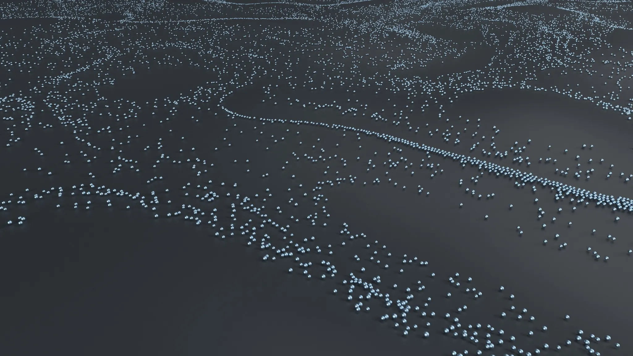
Cover image: Freepik/ kjpargeter
The point cloud promises to make construction monitoring more efficient, but many civil engineers still find themselves frustrated when trying to apply this technology in practice.
To make your life easier, in this article you will understand:
What a point cloud is
How to make it a practical tool
Main applications
Its integration with BIM and much more!
Read the full article and find out how it helps reduce rework and increase predictability.
What is a point cloud?
A point cloud is formed by thousands or even millions of digital points that record a space in three dimensions.
Each point in the cloud carries position information (width (X), depth (Y), and height (Z)) and, often, color or intensity of the reflected laser.
When viewed together, these points create a three-dimensional model with high fidelity of the surfaces of land, structures, and existing objects.
The higher the capture density (with hundreds of points per square meter), the better the precision of the generated digital model.
It is from this base that engineers can create detailed 3D reconstructions, measure volumes and distances with accuracy, and compare what was designed with what is actually being executed on site.
The data is collected by mobile or static 3D laser scanners, drones with LiDAR sensors, or photogrammetry cameras.
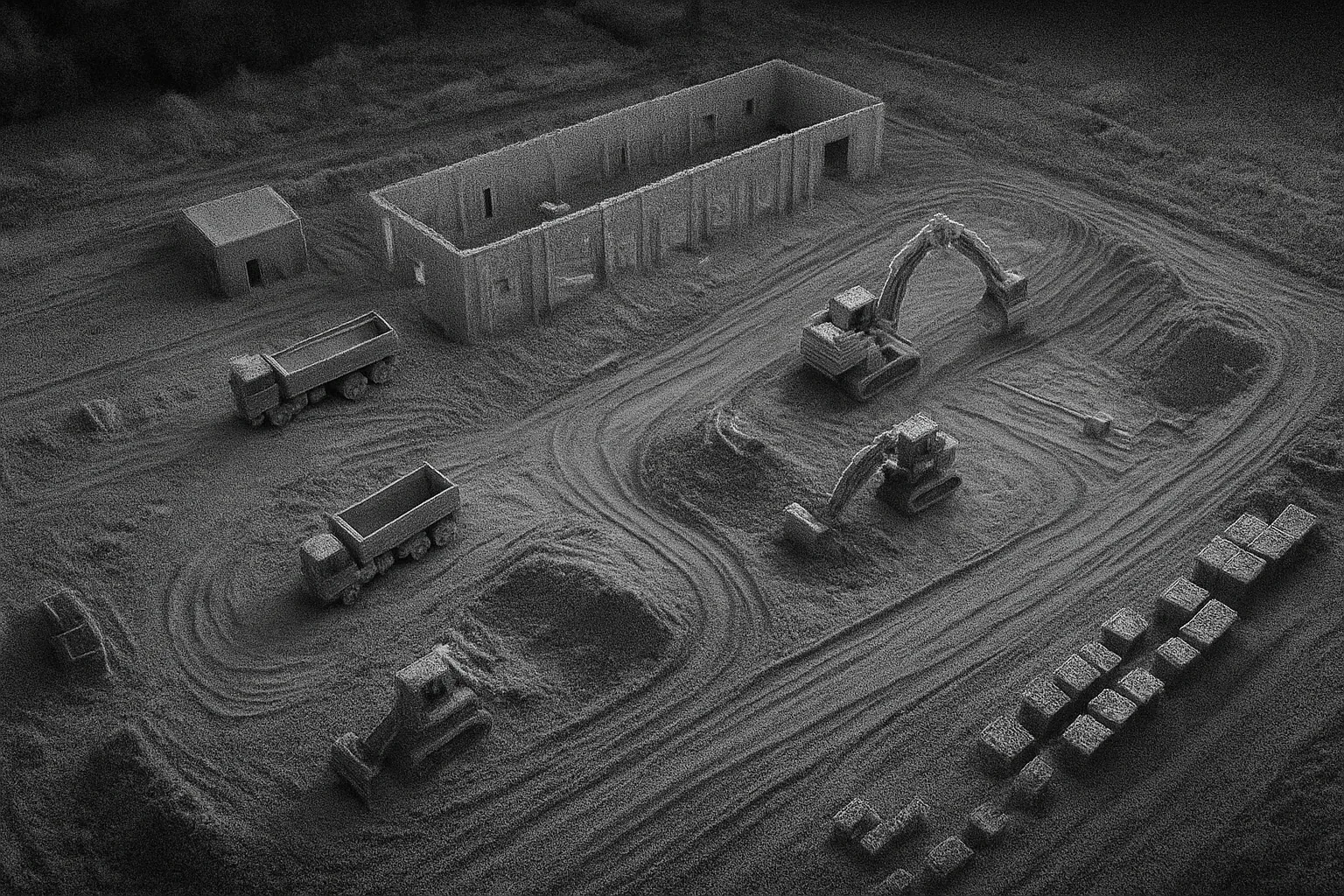
See an example of an image generated by a point cloud:

Image generated by AI
How to generate a point cloud?
The process of creating a point cloud begins with aerial data capture using drones equipped with appropriate sensors and ends with the digital processing of this information.
1. Planning and aerial capture
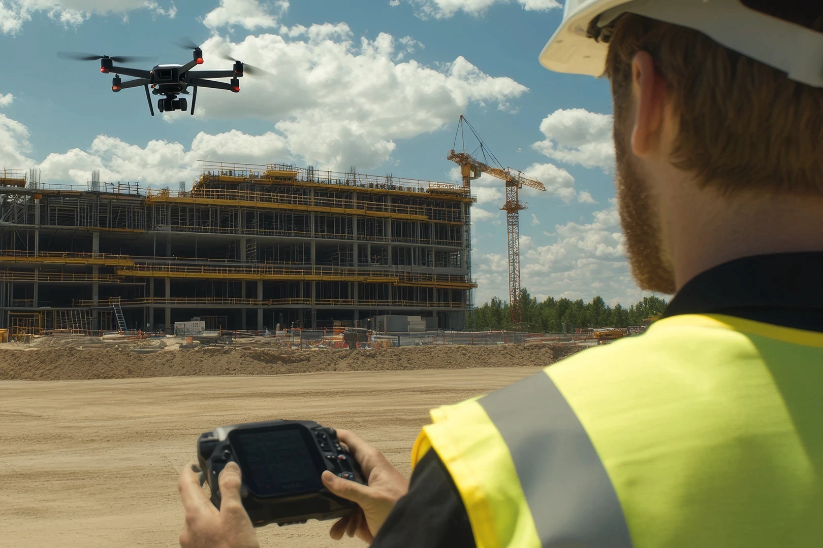
The first step is to fly over the area of interest. For this, a drone (UAV) is used to record data about topography, buildings, and other visual or topographical elements.
2. Choice of sensor
Collection performance depends on the sensor attached to the drone. The choice varies according to the survey objective and the required level of detail. The two most common methods are:
LiDAR (Light Detection and Ranging):
The LiDAR uses laser beams to measure distances and generate high-precision point clouds. This sensor fires thousands of laser pulses per second.
The time each pulse takes to return indicates the exact position of each point in space, combining GPS and inertial sensor information. This method generates large volumes of data in a single scan.
Photogrammetry:
It uses sequences of overlapping photos, captured from various angles, which are then processed to form a 3D model. Since it relies on light, this method requires good natural or artificial lighting conditions.
- Read also: 7 steps to implement technology in civil construction
3. Processing and generation of the point cloud
With the collected data, specific software transforms raw information into a usable point cloud.
Many tools allow real-time monitoring of collection quality, ensuring there are no gaps.

Point cloud versus 360° images
The 360° images, such as those generated by Visi on the construction site, offer a visual and interactive view of the construction, allowing progress to be tracked in a practical and accessible way. They are made with accessible equipment, require only quick training, and provide immediate value for communication, visual inspection, and photographic history of the project.
On the other hand, the point cloud is three-dimensional metric data that enables more precise analyses, measurements, and modeling than a 360° photo. This resource demands suitable equipment, specialized labor, and technique to extract the best result.
In some cases, the two technologies are used together: the point cloud ensures advanced technical precision, while the 360° images complement the visualization of the 3D model with real photographs of the site.
What can you do with a point cloud?
The point cloud allows you to go beyond 3D visualization: with it, you can calculate distances, areas, and volumes, monitor construction progress, generate as-built BIM models, and perform quality inspections with precision.
1. Accurate measurements of distances, areas, and volumes
Software allows measuring between real points, extracting terrain elevations, and calculating areas or volumes directly within the point cloud.
It is also possible to calculate stockpile volumes or earthwork movement using specific tools.
2. Monitoring of physical work progress
By varying cloud captures over time, it is possible to do construction tracking.
It serves to verify the progress of the execution of the work and compare it with the planned schedule. Remembering that captures can be made in conjunction with 360° images.
You will like to know: Construction scheduling in Excel: why this tool is not a good option?
3. Conversion to 2D drawings or "as-built" BIM models
From the point cloud, CAD drawings and BIM "as-built" models adjusted to the actual executed dimensions are generated, allowing the design to faithfully reflect the current state of the construction.
4. Topographical survey:
Create a detailed model of an area for topographical survey purposes that require a quick survey of large areas with high precision.
5. Geometric inspection and quality control
Cloud analysis allows identifying misalignments, deformations, and structural discrepancies, ensuring that construction is in accordance with the design.
6. Construction of digital twins
By integrating continuous captures, the point cloud serves as a foundation for digital twins that can be used for simulation and real-time decision-making.
7. Automatic object recognition and AI analysis
Advanced tools allow detecting and automatically classifying elements such as walls, pipes, and vegetation, optimizing analysis and reducing human errors.
Why use a point cloud together with BIM?
On its own, the point cloud already brings a lot of value, but when used with Building Information Modeling (BIM), the impact is even greater.
While BIM organizes project information into an intelligent model, the point cloud shows the updated reality of execution. This combination generates:
Cost predictability: less rework and greater accuracy in budgets.
Schedule control: continuous monitoring of the physical evolution of the work.
Data-driven decision making: managers and engineers discuss based on facts, not opinions.

Does this technology provide return on investment (ROI)?
Yes. The point cloud reduces rework, saves time, provides transparency to stakeholders, and increases team safety, meaning it transforms technology into efficiency and profit on site.
Visi for more technological construction monitoring
Manage your projects remotely and from anywhere in the world! In addition to 360° images and orthomosaics, Visi delivers point clouds with a specialized 3D scanning service, raising the level of precision in construction monitoring and documentation.
There are more than 20 features on your computer screen, such as: 360º photos, ground and aerial photos, drone mapping, point clouds, and much more.
Additionally, you can prepare Daily Construction Reports (DCR), checklists, punch lists, and much more in minutes. Everything is organized, traceable, and easy to query on the Visi platform.
The point cloud promises to make construction monitoring more efficient, but many civil engineers still find themselves frustrated when trying to apply this technology in practice.
To make your life easier, in this article you will understand:
What a point cloud is
How to make it a practical tool
Main applications
Its integration with BIM and much more!
Read the full article and find out how it helps reduce rework and increase predictability.
What is a point cloud?
A point cloud is formed by thousands or even millions of digital points that record a space in three dimensions.
Each point in the cloud carries position information (width (X), depth (Y), and height (Z)) and, often, color or intensity of the reflected laser.
When viewed together, these points create a three-dimensional model with high fidelity of the surfaces of land, structures, and existing objects.
The higher the capture density (with hundreds of points per square meter), the better the precision of the generated digital model.
It is from this base that engineers can create detailed 3D reconstructions, measure volumes and distances with accuracy, and compare what was designed with what is actually being executed on site.
The data is collected by mobile or static 3D laser scanners, drones with LiDAR sensors, or photogrammetry cameras.
See an example of an image generated by a point cloud:
Image generated by AI
How to generate a point cloud?
The process of creating a point cloud begins with aerial data capture using drones equipped with appropriate sensors and ends with the digital processing of this information.
1. Planning and aerial capture
The first step is to fly over the area of interest. For this, a drone (UAV) is used to record data about topography, buildings, and other visual or topographical elements.
2. Choice of sensor
Collection performance depends on the sensor attached to the drone. The choice varies according to the survey objective and the required level of detail. The two most common methods are:
LiDAR (Light Detection and Ranging):
The LiDAR uses laser beams to measure distances and generate high-precision point clouds. This sensor fires thousands of laser pulses per second.
The time each pulse takes to return indicates the exact position of each point in space, combining GPS and inertial sensor information. This method generates large volumes of data in a single scan.
Photogrammetry:
It uses sequences of overlapping photos, captured from various angles, which are then processed to form a 3D model. Since it relies on light, this method requires good natural or artificial lighting conditions.
- Read also: 7 steps to implement technology in civil construction
3. Processing and generation of the point cloud
With the collected data, specific software transforms raw information into a usable point cloud.
Many tools allow real-time monitoring of collection quality, ensuring there are no gaps.
Point cloud versus 360° images
The 360° images, such as those generated by Visi on the construction site, offer a visual and interactive view of the construction, allowing progress to be tracked in a practical and accessible way. They are made with accessible equipment, require only quick training, and provide immediate value for communication, visual inspection, and photographic history of the project.
On the other hand, the point cloud is three-dimensional metric data that enables more precise analyses, measurements, and modeling than a 360° photo. This resource demands suitable equipment, specialized labor, and technique to extract the best result.
In some cases, the two technologies are used together: the point cloud ensures advanced technical precision, while the 360° images complement the visualization of the 3D model with real photographs of the site.
What can you do with a point cloud?
The point cloud allows you to go beyond 3D visualization: with it, you can calculate distances, areas, and volumes, monitor construction progress, generate as-built BIM models, and perform quality inspections with precision.
1. Accurate measurements of distances, areas, and volumes
Software allows measuring between real points, extracting terrain elevations, and calculating areas or volumes directly within the point cloud.
It is also possible to calculate stockpile volumes or earthwork movement using specific tools.
2. Monitoring of physical work progress
By varying cloud captures over time, it is possible to do construction tracking.
It serves to verify the progress of the execution of the work and compare it with the planned schedule. Remembering that captures can be made in conjunction with 360° images.
You will like to know: Construction scheduling in Excel: why this tool is not a good option?
3. Conversion to 2D drawings or "as-built" BIM models
From the point cloud, CAD drawings and BIM "as-built" models adjusted to the actual executed dimensions are generated, allowing the design to faithfully reflect the current state of the construction.
4. Topographical survey:
Create a detailed model of an area for topographical survey purposes that require a quick survey of large areas with high precision.
5. Geometric inspection and quality control
Cloud analysis allows identifying misalignments, deformations, and structural discrepancies, ensuring that construction is in accordance with the design.
6. Construction of digital twins
By integrating continuous captures, the point cloud serves as a foundation for digital twins that can be used for simulation and real-time decision-making.
7. Automatic object recognition and AI analysis
Advanced tools allow detecting and automatically classifying elements such as walls, pipes, and vegetation, optimizing analysis and reducing human errors.
Why use a point cloud together with BIM?
On its own, the point cloud already brings a lot of value, but when used with Building Information Modeling (BIM), the impact is even greater.
While BIM organizes project information into an intelligent model, the point cloud shows the updated reality of execution. This combination generates:
Cost predictability: less rework and greater accuracy in budgets.
Schedule control: continuous monitoring of the physical evolution of the work.
Data-driven decision making: managers and engineers discuss based on facts, not opinions.
Does this technology provide return on investment (ROI)?
Yes. The point cloud reduces rework, saves time, provides transparency to stakeholders, and increases team safety, meaning it transforms technology into efficiency and profit on site.
Visi for more technological construction monitoring
Manage your projects remotely and from anywhere in the world! In addition to 360° images and orthomosaics, Visi delivers point clouds with a specialized 3D scanning service, raising the level of precision in construction monitoring and documentation.
There are more than 20 features on your computer screen, such as: 360º photos, ground and aerial photos, drone mapping, point clouds, and much more.
Additionally, you can prepare Daily Construction Reports (DCR), checklists, punch lists, and much more in minutes. Everything is organized, traceable, and easy to query on the Visi platform.
Cover image: Freepik/ kjpargeter
Sobre o autor
Tales Silva
CEO & founder, Construct IN
Tales Silva é Engenheiro Civil formado pela PUCRS (2016) e possui MBA Executivo com foco em marketing pela ESPM-Sul (2019). Tem experiência em projetos estruturais e em construções industrializadas. É fundador e CEO da Construct IN, construtech que oferece uma plataforma de gestão e documentação de obras por meio de imagens 360º.
cOMPARTILHE NAS REDES
Recomendado para você
carregar mais ↓



Subscribe to our newsletter
Explore nossas soluções
Entre em contato e descubra como a captura da realidade e dados centralizados podem ser a solução para a gestão de suas obras.
